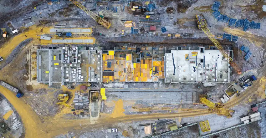
Construction progress monitoring

A) 360 Degree Photography
Using a 360 camera for construction progress is a great idea! These cameras can capture comprehensive, immersive views of a construction site, providing valuable visual documentation and aiding in project management. Person with 360 camera mounted on safety helmet roam around the construction site on prefixed path and take pictures from same location every round.
Here are a few benefits and considerations:
360 images Nedd to open in our platform where you can compare 360 images with previous images of same location and 360 image with same location with BIM image.
B) DSLR/Surface photography for construction progress
Person with professional DSLR camera roam around the site on fix path take photographs of site progress on regular interval. Photographs mostly used for site progress presentation to the stakeholders.
C) Drone Photography and Videography
Service Overview: Our Drone Photography and Videography service specializes in capturing high-quality aerial imagery and video footage to monitor and document the progress of construction sites.
Key Features:
- Aerial Imaging and Videography: Our drones capture high-resolution images and video footage from various angles and altitudes, offering a unique perspective that ground-based photography cannot achieve.
- Consistent Flight Paths: To ensure accurate and comparable progress monitoring, our drones follow the same flight paths each time they are deployed.
- Detailed Progress Reports: We deliver detailed reports that include annotated images and video footage, highlighting key areas of progress and any significant changes or issues.
- High-Resolution Imaging: Our drones are equipped with high-resolution cameras that capture detailed images and videos, ensuring that even the smallest aspects of the construction progress are visible and documented.
- Timely and Regular Updates: We offer flexible scheduling options for drone flights to align with your project's timeline and reporting needs.
- Enhanced Project Visualization: The aerial perspective provided by drone imagery allows for a comprehensive view of the entire construction site.
- Advanced Data Integration: Our service can integrate with existing project management tools and software.
- Compliance and Safety: We adhere to all relevant aviation regulations and safety guidelines.
Benefits:
- Accurate Monitoring: Consistent aerial imagery enables precise tracking of construction progress.
- Improved Communication: High-quality visuals enhance communication with clients, stakeholders, and team members.
- Comprehensive Documentation: Detailed aerial footage offers a complete record of the construction process.
- Efficiency and Cost-Effectiveness: Drone photography reduces the need for manual site visits.
How It Works:
- Pre-Flight Planning: We coordinate with your team to determine the optimal flight paths, scheduling, and specific areas of interest for each drone flight.
- Drone Deployment: Our certified drone operators conduct flights following the predetermined paths, capturing high-resolution images and video footage of the construction site.
- Data Processing: We process and organize the captured data, creating detailed reports and visual documentation.
- Delivery: We deliver the finalized reports and media through secure digital channels.
D) Construction Progress Monitoring with Graphical Editing
Our Construction Progress Monitoring service combines high-resolution drone video footage with advanced graphical editing to provide clear and insightful visual documentation of your project.
Key Features:
- Aerial Video Footage: We capture detailed, high-resolution video of your construction site from a drone.
- Graphical Annotations: Our service includes graphical editing where we overlay pop-up markers and animations directly onto the video.
- Dynamic Boundaries: We animate boundary lines and other important markers to visually track changes over time.
- Enhanced Clarity: By integrating graphical elements with video, we provide a clear and engaging representation of your construction site.
This service delivers both precise progress monitoring and visually enhanced reports, ensuring you have a detailed and easily interpretable overview of your construction project.