img

Powerline and Gas Pipeline Inspection Using Thermal and LiDAR Drone Technology

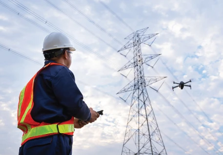
Our comprehensive inspection service utilizes advanced drone technology to perform detailed and efficient inspections of powerlines and gas pipelines. Combining thermal imaging with LiDAR scanning, we offer a robust solution for identifying potential issues and ensuring the integrity of critical infrastructure.

Our Powerline and Gas Pipeline Inspection service uses advanced thermal and LiDAR drone technology to provide detailed, high-resolution assessments. Thermal drones detect heat anomalies and potential issues in real-time, while LiDAR scans deliver precise 3D mapping and structural insights. This combined approach ensures early problem detection, accurate measurements, and efficient inspections, enhancing safety and reducing operational costs.
Key Features

img

Thermal Drone Camera Inspection

  • Heat Detection: Our drones are equipped with high-resolution thermal cameras that detect heat anomalies along powerlines and gas pipelines. This allows for the identification of overheating components, insulation failures, and potential leaks.
  • Non-Destructive Testing: Thermal imaging provides a non-invasive way to inspect infrastructure, minimizing disruption while identifying problems such as hot spots in powerlines or gas leaks in pipelines.
  • Real-Time Monitoring: The thermal drone provides real-time data, enabling immediate assessment and response to potential issues detected during the flight.

LiDAR Scanning Drone Inspection

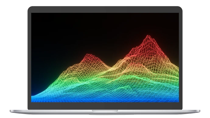
  • High-Precision Mapping: LiDAR-equipped drones capture precise, three-dimensional data of powerlines and pipeline routes. This includes detailed elevation profiles and spatial relationships between infrastructure components.
  • Detailed Point Clouds: The LiDAR data generates dense point clouds that reveal structural details, vegetation encroachment, and alignment issues, which are critical for maintenance and planning.
  • Geospatial Analysis: The data can be integrated with GIS for advanced spatial analysis, helping in the assessment of long-term changes and planning of corrective actions.
img
img

Comprehensive Data Integration

  • Combined Reporting: We integrate thermal and LiDAR data into comprehensive reports, highlighting detected issues, providing visual evidence, and offering actionable insights.
  • Visual and Quantitative Analysis: Thermal imagery provides visual evidence of temperature anomalies, while LiDAR data offers quantitative measurements of structural and spatial conditions.

Enhanced Safety and Efficiency

  • Minimized Risk: Using drones for inspections reduces the need for personnel to work at height or in hazardous conditions, enhancing overall safety.
  • Rapid Assessment: The combined use of thermal and LiDAR technology allows for quick, thorough inspections of extensive infrastructure, reducing downtime and improving operational efficiency.
img
BENEFITS
img
Software Research

Thermal imaging identifies potential problems before they escalate, enabling proactive maintenance and reducing the risk of system failures


img
Accurate Measurements

LiDAR scanning provides precise, detailed measurements of infrastructure, essential for effective monitoring and planning

img
Comprehensive Insights

The combination of thermal and LiDAR data offers a complete view of the condition of powerlines and pipelines, supporting informed decision-making

img
Efficient and Cost-Effective

Our drone inspections cover large areas quickly and efficiently, minimizing operational costs and time compared to traditional methods